2. Project Site Conditions
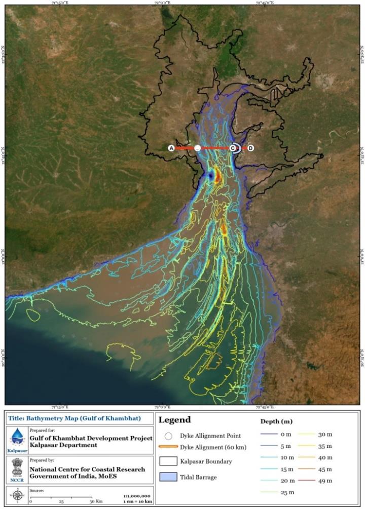
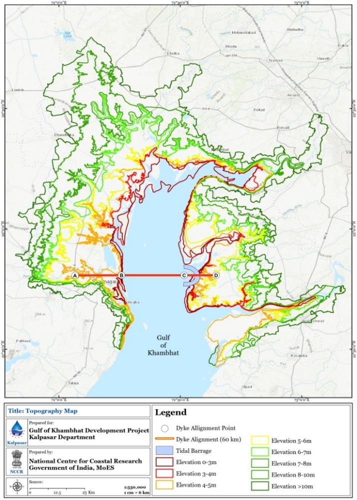
The Gulf of Khambhat is an inlet to the Arabian Sea along the west coast of India, of the rivers of the state of Gujarat. GoK is a converging and a highly energetic macro-tidal regime of the north-eastern Arabian Sea. The Gulf boundary is 153 km stretch between Pipavav in the state of Gujarat and Daman in the Union territory of Daman and Diu. The GoK has a width of 80 km at the mouth and funnels down to 25 km over a longitudinal reach of 140 km. The project area up to +10 m has a systematic slope with low gradients tapering towards the Gulf. The tidal mud flats are the dominant and continuously present landforms. They are grossly flat interspersed with raised mud flats, bets, mangrove swamps, island bars and offshore bars. The low-level tidal mudflats are diurnally submerged while the higher-level tidal mudflats are periodically submerged when the tide levels are high. The bathymetry of the Dyke alignment indicates the presence of four main channels separated by ridges on either side with some of them discontinuous or at places merging with the other channels. The analysis of bathymetry reveals that the earlier bathymetry of 1973 NHO chart, of the surveyed period as 1897 in the northern portion north of Dyke corridor, has undergone drastic changes with the shifting of 4 channels up to almost 1.6 km. The Bathymetry along the intertidal region varies from 11.71 m to -18.68 m. The bathymetry values are low along the dyke area. The maximum tidal range of more than 10 m is recorded in GoK along with maximum currents of 3.3 m/s. The range of wind speeds during June to August is noted to be 8-12 m/s, while it is 2-6 m/s during winter months. Wind directions during south west monsoon are southwesterly to westerly and are north easterly to northerly during winter.